Strong cap eliminates Nebraska tornado potential on 5/5/12
Originally published on davieswx.blogspot.com ↗
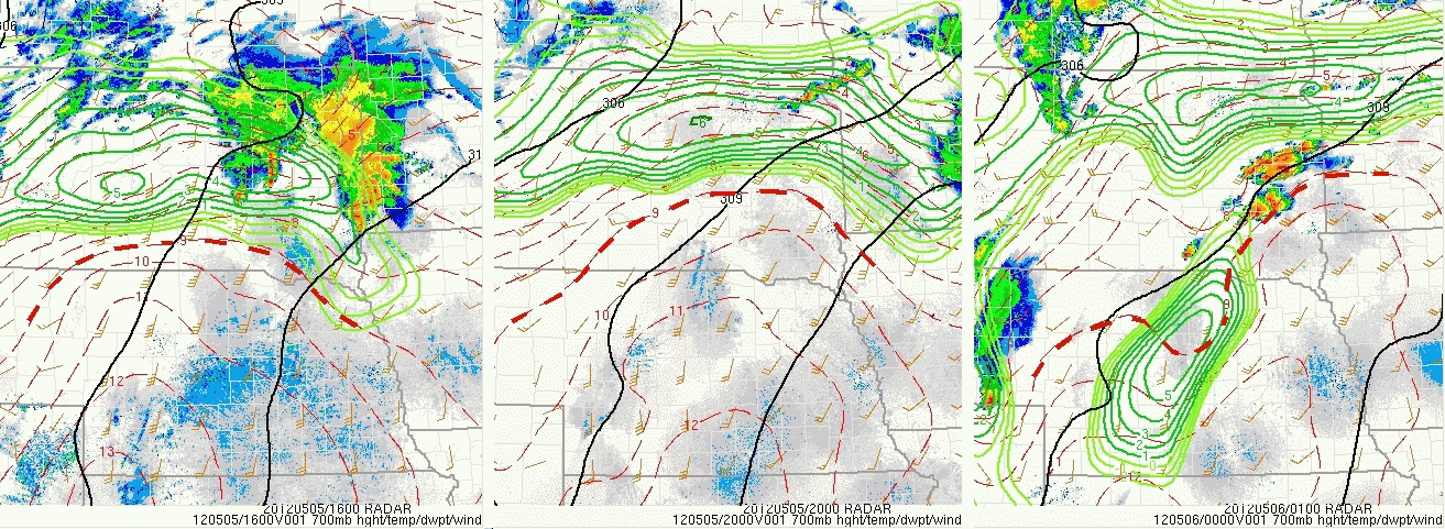
Saturday 5/5/12 over Nebraska was a good example of a “cap” bust where the surface warm sector was overlain by warm temperatures aloft at around 10,000 ft MSL (the “cap”, see 700 mb 9 deg C isotherm on SPC graphics above through the day) that kept warm sector storms from forming. This effectively eliminated any tornado potential for a day that had looked much more threatening on computer models a couple days before. My wife Shawna and I saw this looking at morning and early afternoon data, and were concerned that daytime storms would be limited to the elevated environment north of the surface front . So we elected not to storm chase today.
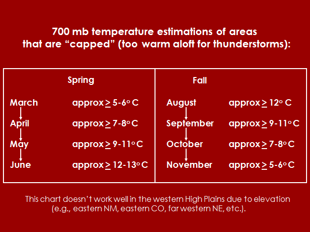
The chart above is a rough seasonal guideline I use regarding 700 mb temperatures that estimate the “cap” during maximum heating in the Central Plains. Notice that 9 deg C (give or take a degree) is a very rough estimate of the “cap” in early May, and that was a good indicator today using the earlier SPC graphics.
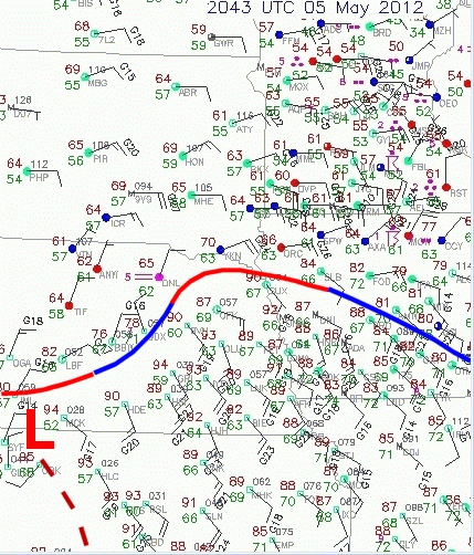
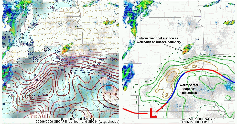
The SW-NE stationary surface boundary over Nebraska (see map above) was “covered” by this cap through most of the day, which kept storms from initiating over central and northeast Nebraska in the warm sector. It can also be seen on the SPC SBCAPE and EHI graphics above that the first cell to form in the evening was well north of this surface boundary in South Dakota and far away from a truly surface-based environment. Storms did form in a line around and after dark behind the front (not shown) as the cap eroded from the west with the approach of an upper short wave of energy. But the warm sector tornado threat was eliminated by the cap.
Yesterday, it came to my attention that someone was passing around Facebook a version of the SRH-CAPE chart I posted last year to suggest environment potential (low-level wind shear and instability) for significant tornadoes, using that to show how 5/5/12 would be a big tornado day in Nebraska. Well… What actually happened on 5/5/12 is major reminder that tornado forecasting is about a lot more than just environment… It involves assessing the surface pattern and warm sector orientation relative to where storms initiate (see my last post about April 27), as well the positioning and evolution of any “capped” areas that can keep storms from developing. Severe weather forecasting is not simple stuff.
- Jon Davies 5/5/12